All of the following photographs were taken between 12:30PM and 2:45PM today (October 30, 2012) after the peak of the last elevated high tide resulting from Hurricane Sandy.
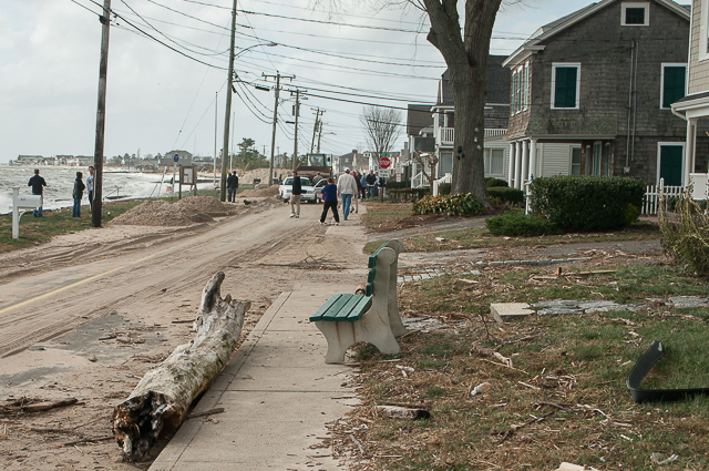
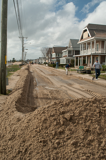
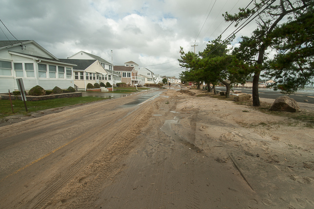
Looking down Seaside Avenue from the intersection with Post Avenue.
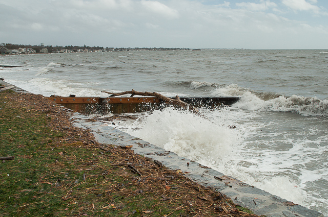
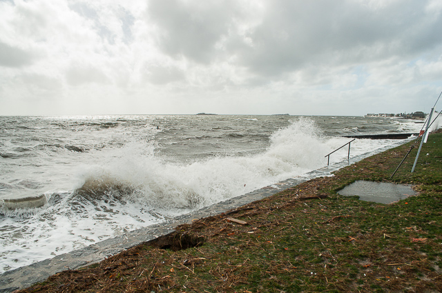
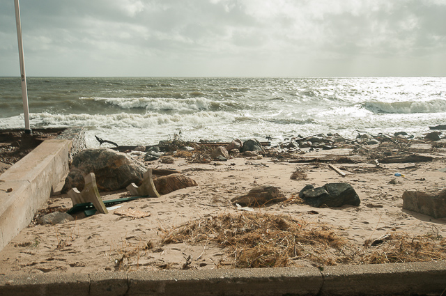
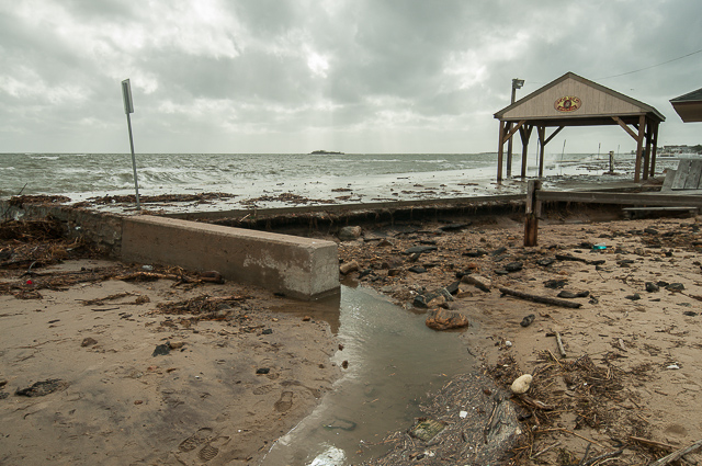
Waves were still crashing against the seawall. You can also see that an entire tree was hung up on the jetty.
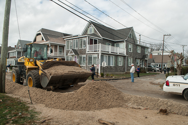
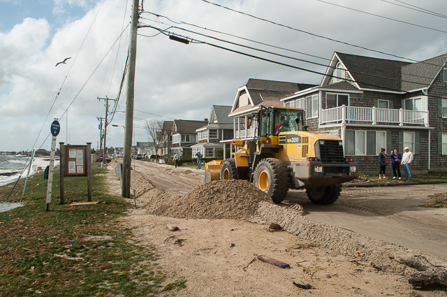
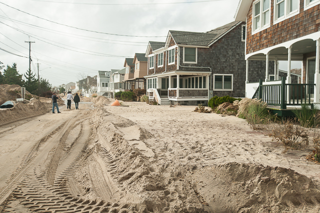
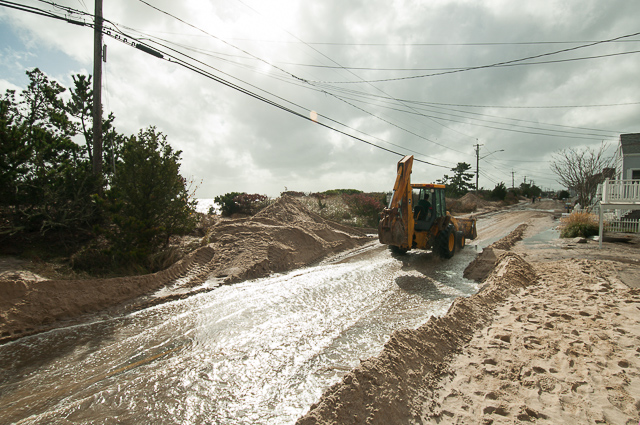
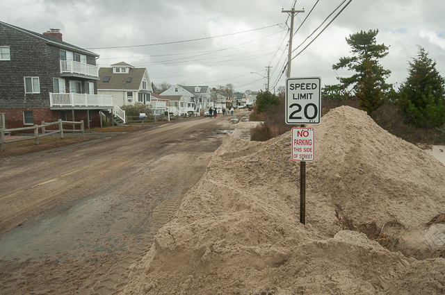
Digging out enough room for cars to pass (near the Seaside Ave-Post Ave intersection).
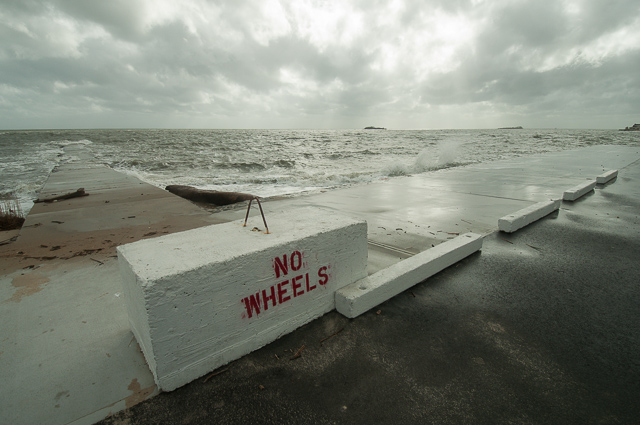
Notice the bench (made of concrete) that has been thrown around and half-buried in the rubble on the beach.
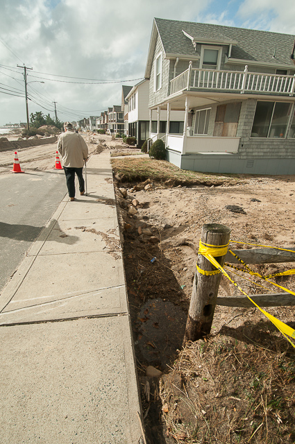
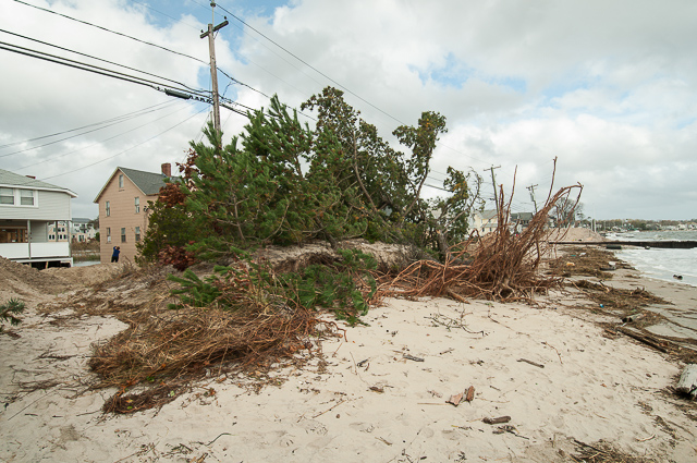
Plenty of erosion near the sidewalk. At this point, much of major road clearing was complete and we had been allowed to move west down Seaside Ave from the intersection with Post Ave.
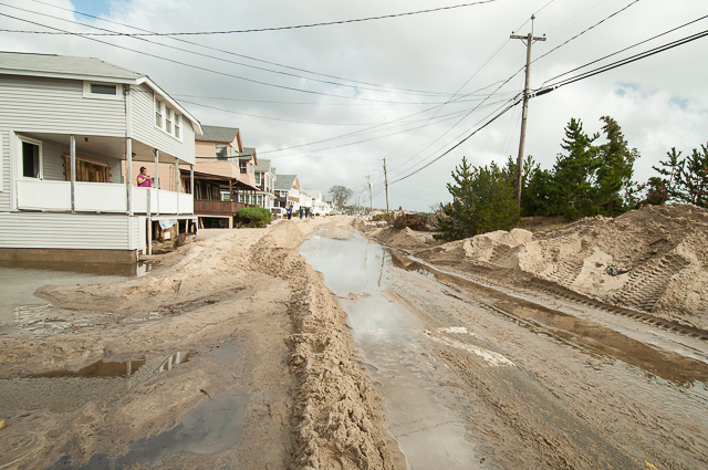
TONS of sand… literally…
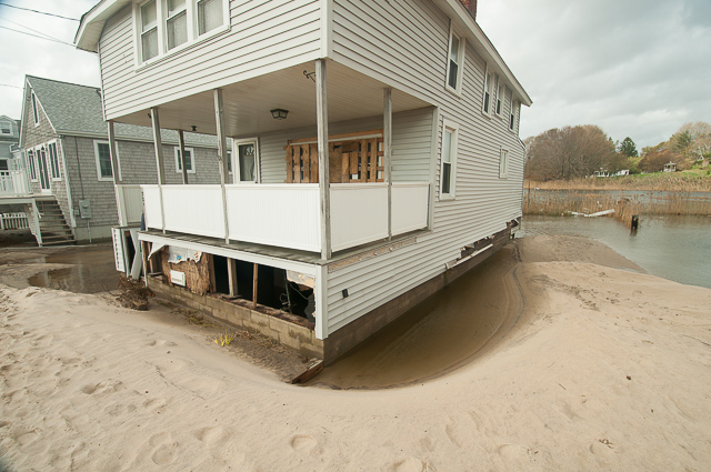
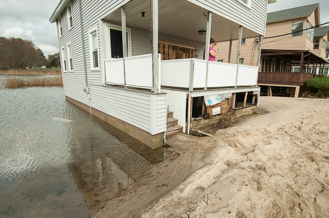
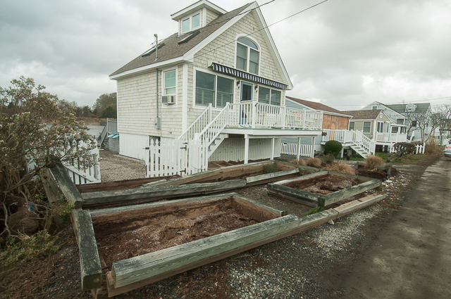
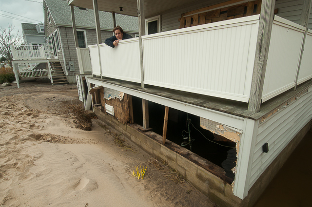
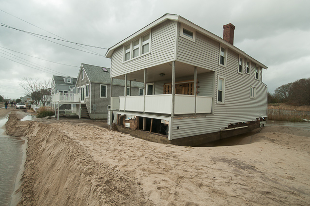
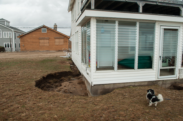
And then we come to our cottage. It’s still standing -which is great- but the wall beneath the porch is gone and we definitely lost some other siding.
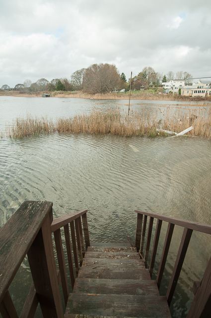
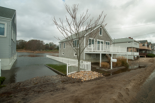
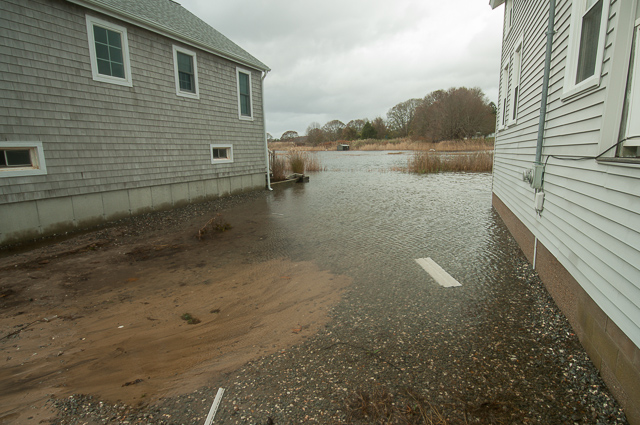
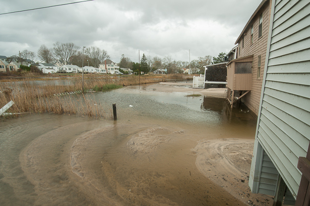
At this point (about 1:00PM or so) the water was still extremely high, as evidenced by the view from the stairs in the back. Oh, and those long slats stuck in the reeds to the right… that’s our siding.
Also, if you look to the left-hand side of the photo on the opposite side of the marsh, you’ll see a shed (it’s pretty far off, so you might have to squint). That shed used to be a few houses down from ours before the hurricane. It literally floated all the way across the marsh in one piece and got dropped on the other side.
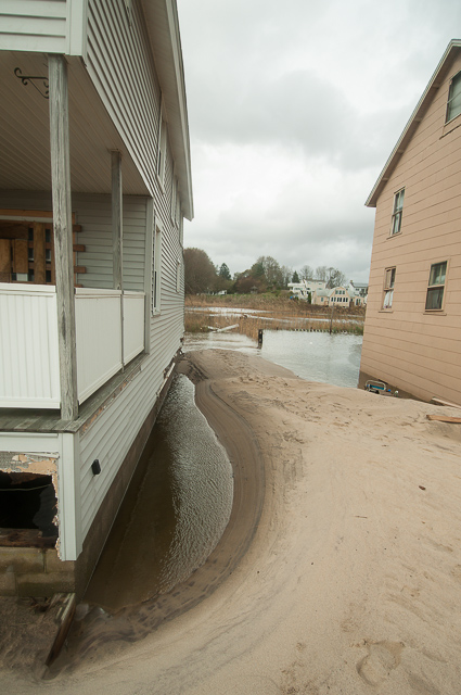
The sand is piled as much as 3 to 4 feet deep; truly an incredible amount of sand.
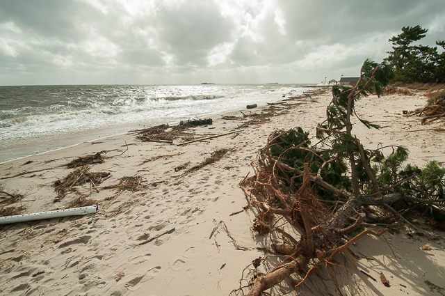
The largest Pitch Pine on the dunes was completely undermined by the storm surge. After at least 6 to 10 feet of the dunes had been eaten away, there was nothing left to hold it in the ground and it must have simply fallen over. Otherwise, it was still intact.
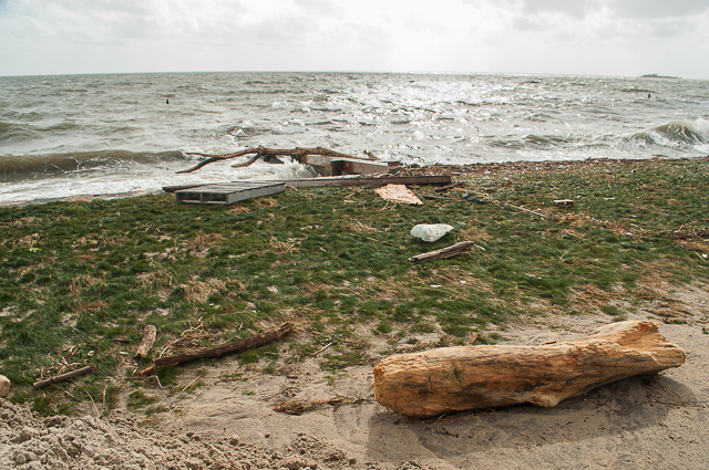
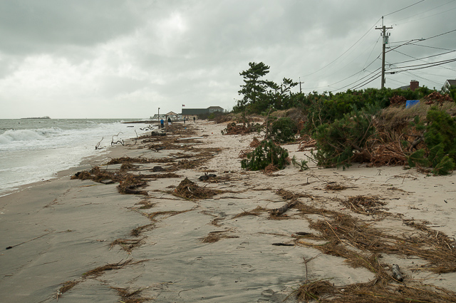
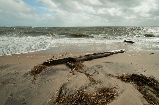
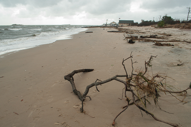
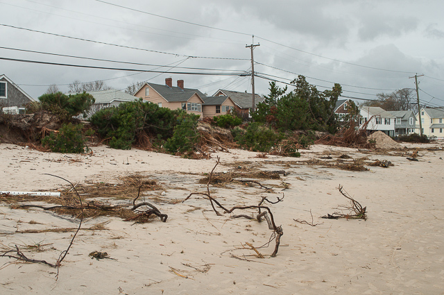
Debris washed up on the beach…
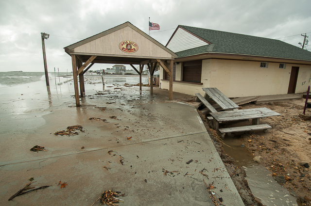
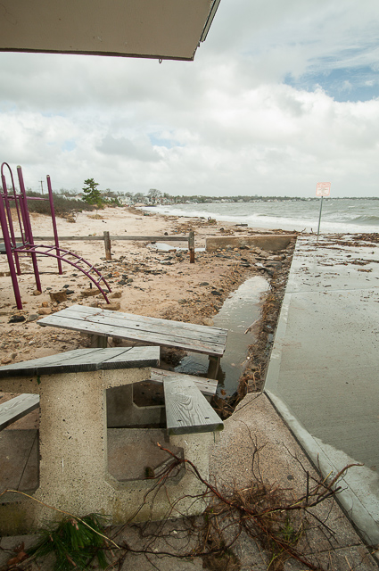
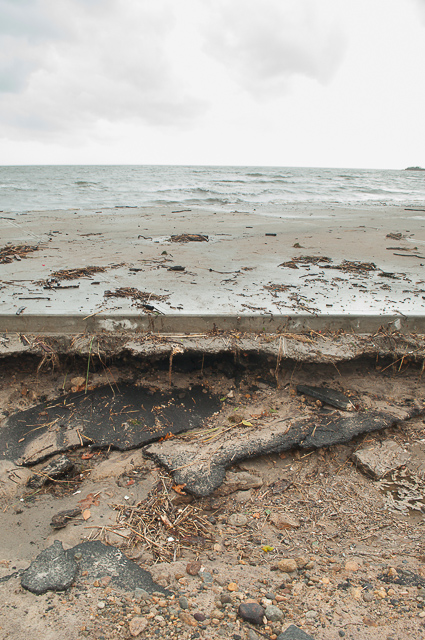
For the most part, this area of the public beach held up rather well. Last year it was undermined and ultimately destroyed once the seawall broke. This year, the seawall held. The newer concrete slab was still intact. As you can see though, all of the sand that used to be beside the concrete slab has been washed away.
So much for those benches.
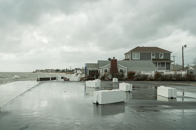
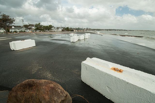
Again, I want to point out how well the town beach parking lot held up this year; pretty much unscathed! That’s especially remarkable, since the surge was so strong that it was able to toss around those enormous concrete blocks!
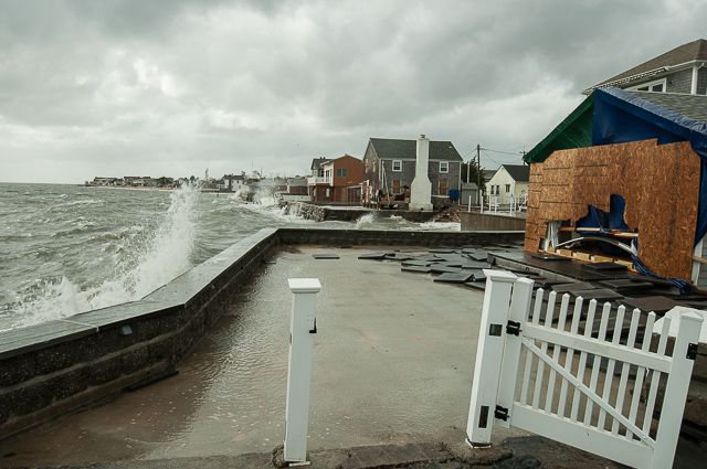
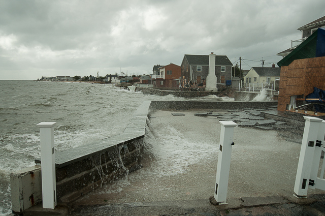
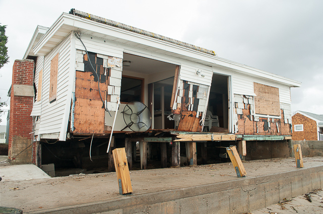
Looks like plywood just couldn’t hold back the surge from rushing into this cottage. You’ll notice that, even more than an hour after high tide today, waves were STILL breaking over their patio wall. Waves were also still battering the sea walls of cottages in the distance.
On Seaside Avenue, near the town beach parking lot…
Hey look, more of our siding! Quick… grab it!
Did I mention the sand?
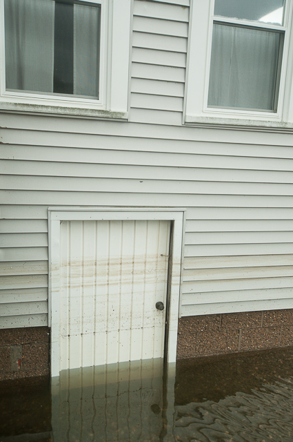
Here you can see the lines on the basement door that show the average water level at the peak of Hurricane Sandy. And, of course, that only represents the average water level… it doesn’t include the 3 to 7 foot waves.
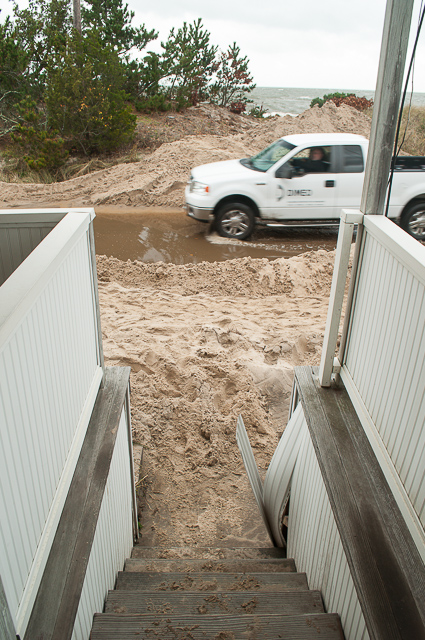
Well, the beach now starts at the very bottom of the front porch stairs…
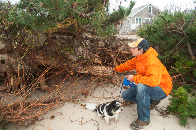
Jordan and Optimus taking a look at the exposed roots of undermined Pitch Pines on the dunes.
This is another shot of the concrete slab near the food stand at the town beach. Notice that there’s fragmented asphalt underneath the concrete. That’s what was left of the old asphalt pad after Hurricane Irene… it had been covered up with the new concrete.
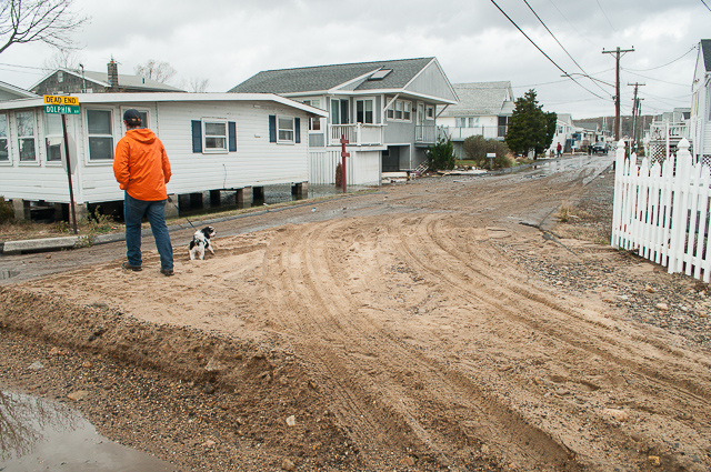
Seaside Ave at Dolphin Ave: sand covering the street.
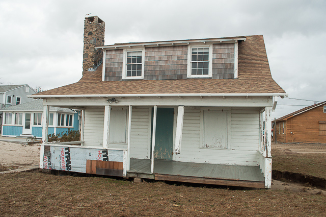
The damage to this cottage was just shocking. After seeing this place, I can only be thankful that our cottage was spared by comparison.
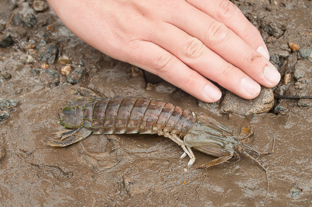
Okay, this photo requires a short explanation. This is a Mantis Shrimp, a creature that avoids the seashore, instead preferring deeper water of Long Island Sound. To put it plainly, you will never find these creatures while walking the sandbars. The fact that we found this one in a muddy driveway on Seaside Ave is a testament to the intense power of this hurricane; it really churned up EVERYTHING in the Sound.

Justin: The pic of our driveway washed away under the sidewalk….the washout goes all the way to the middle of the road…. It looks like that pushed the sand they put on the beach over to our driveway in the first shot of this..out of sinc, but good to see they did something right after the wrong. Our cottages were built in 1898….seen a lot of weather in their lifetime and thankfully still standing……
Excellent awesome devastating pics. They make me want to feel sorry for us all! Great job!
Great pictures, your cottage used to be our (grandmother) cottage. It was sold in the early 70’s. My uncle who just turned 90 was born in that house. We have great memories summers spent in Westbrook.
Wow, Tom, what a coincidence! Do you happen to have any photos you could scan and email over to us? The cottage has been through so many renovations, I would love to see early pictures!
Justin
Awesome pictures (as usual). It looks hurt…but I’m glad the cottage is still standing.