I took all of the following photographs between roughly 3PM and 5PM on Sunday, August 28. We walked west along the beach to the shoreline beside Menunketesuck Island. We also walked west along the street to the roads within the Pilot’s Point community.
A few waterlines on the siding of the cottage suggest that the water level rose to the ceiling of the basement, however these waterlines aren’t visible in any of my photographs. I have drawn a red, dotted line on the first photograph which demonstrates where the mean waterline was along the siding. The position of debris lodged in the back steps, as well as other waterlines, indicate that swells occasionally rose at least one foot above the mean waterline during the surge (perhaps higher). The interior living space did not take on any water.
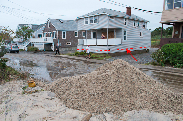
Here’s our cottage… still in one piece, thankfully.
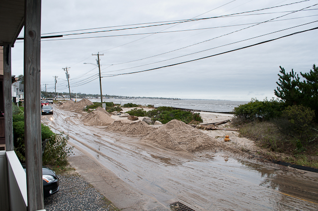
But… as you can see, there was an enormous amount of sand on the street. Bulldozers tried to pile it up as much as possible, allowing travel in at least one lane.
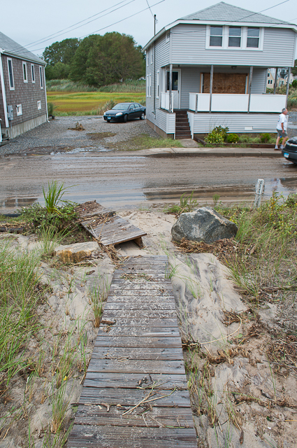
The walkway to the beach was tossed around and you can see just how much water must have been traveling over it.
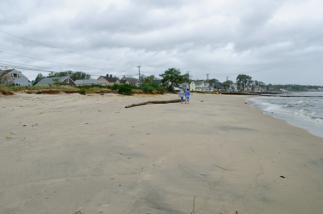
The entire beach looks different, since all the loose sand has been washed away. What remained was a uniformly flat, hard-packed sand. In some areas, a considerable amount of dune plants were washed away.
All of the wooden jetties were unscathed.
Here you can see just how much of the beach was displaced… at least the top 12″ of beach sand is gone, maybe more in some places. Much of this sand, of course, ended up on the street.
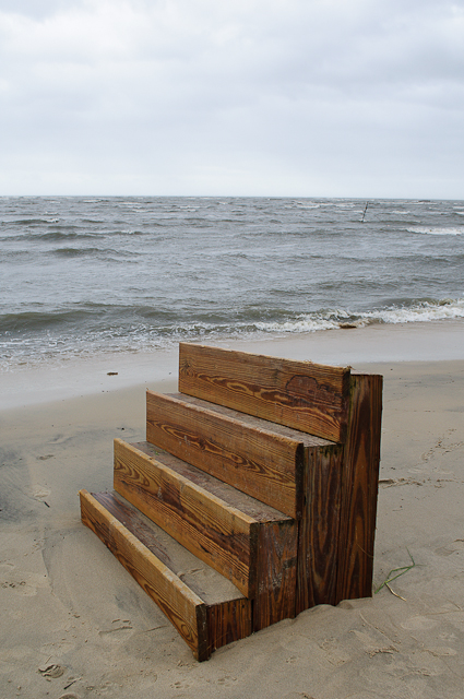
This set of stairs was buried in the sand on the beach about 100 feet west of our cottage…
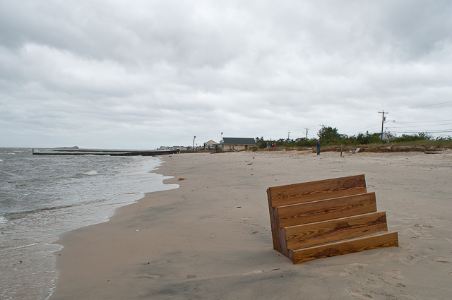
…it was buried so deeply that it couldn’t be moved by hand.
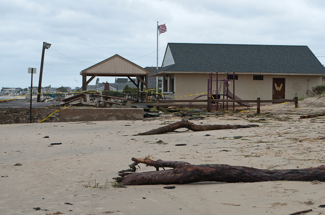
Closer to the ice cream stand, there were a few large, driftwood trees left on shore.
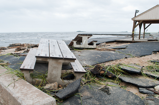
The asphalt and tables beside the stand were demolished.
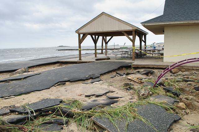
Everything sank as the sand washed out from underneath, allowing the surge to tear apart the asphalt.
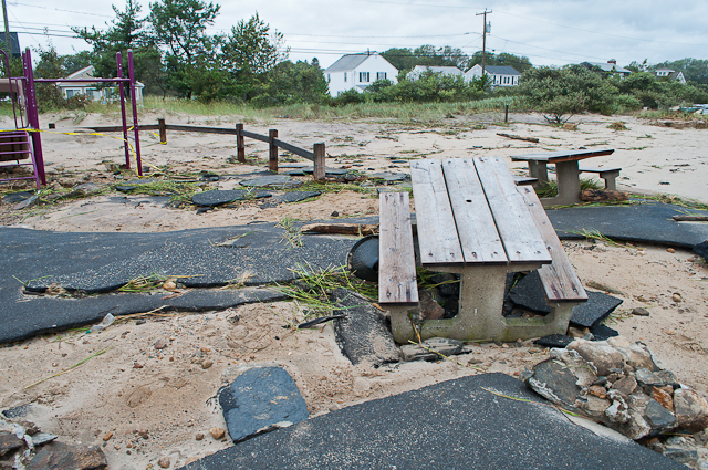
The concrete tables were tossed around.
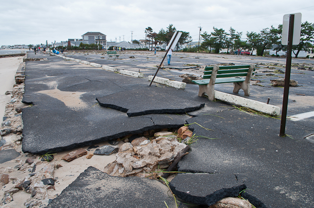
To the left in this photo, you can see that the top literally ripped off of the seawall in front of the public parking lot. This allowed seawater to rush underneath the walkway and parking lot, causing incredible damage.
In this shot, you can also see that entire slabs of asphalt, after having broken loose, were actually tossed around by the water. The chunk in the middle of the frame was moved with enough force to bend the steel sign post. Also, notice that the concrete bench was being pushed inland; it was only stopped by the concrete block at the head of the parking space, which is fastened to the ground.
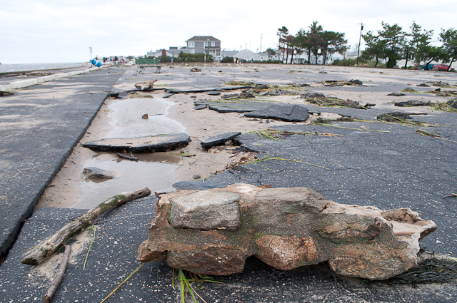
Here’s a big chunk of the seawall that has been tossed into the parking lot.
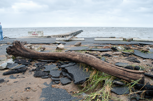
An entire tree left in the parking lot just behind the rock jetty. The rock jetty appeared entirely unscathed, by the way.
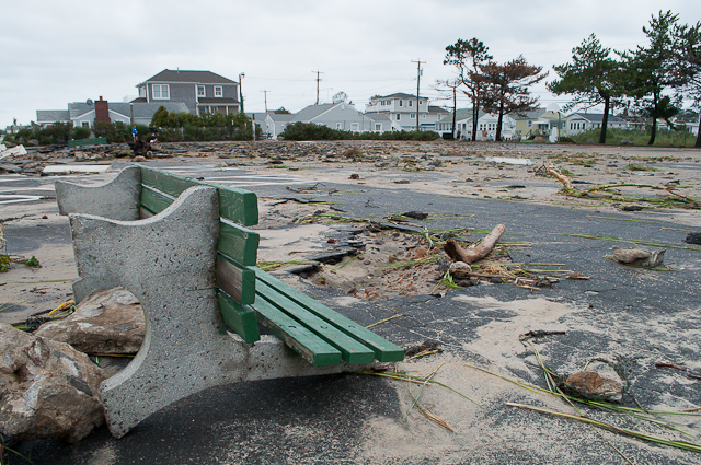
Conrete benches overturned.
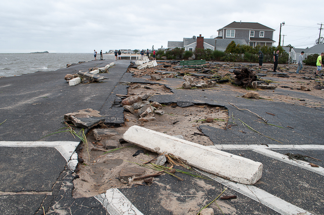
A solid, concrete block was tossed about 6 feet from its original location at the head of a parking space.
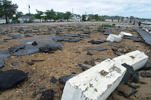
The public parking lot from the western end… completely reduced to rubble.
Further down the beach, a deck is snapped in half. Towards Pilot’s Point, where numerous cottages sit directly on the waterfront, waves certainly made direct, forceful contact with structures. Many were flooded and suffered damage, but none collapsed.
Close to the Pilot’s Point entrance, there was still 1 to 2 feet of standing water.
A jellyfish that was left on the sidewalk after the surge withdrew.
